

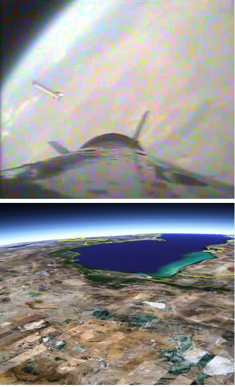
Well, I don’t know that its at its peak, perhaps the payload continued on for quite a ways. But what interested me about this picture (other than its really cool and it indicates that Iran is definitely studying its “staging” procedures using rocket-cams) is the possibility that this picture could be used to tell how high the Kavosh went. However, when I think about it, there doesn’t seem to be enough information to use the apparent curvature of the Earth to gauge the height.
One thing that I thought might work was to use GoogleEarth to tell how high the payload was when it took this picture by comparing landmarks. So if I say that the blue blob near the top of the image, which is also near the Earth’s limb, is the Caspian Sea with cloud cover away from the southern shore, then I estimate a height of about 200 km. But this is, of course, a very crude “calculation.” I would say it was consistent with my earlier calculations of how far a Zalzel missile would go, which shows how much faith I put in this method since I calculated about 140 km altitude.
Can any of you Wonk-readers see a better way of calculating this altitude? For instance, am I wrong about the scaling of the Earth’s curvature?